History of Llanerch
A (fairly) comprehensive history of the historic homes of Llanerch in Haverford Township
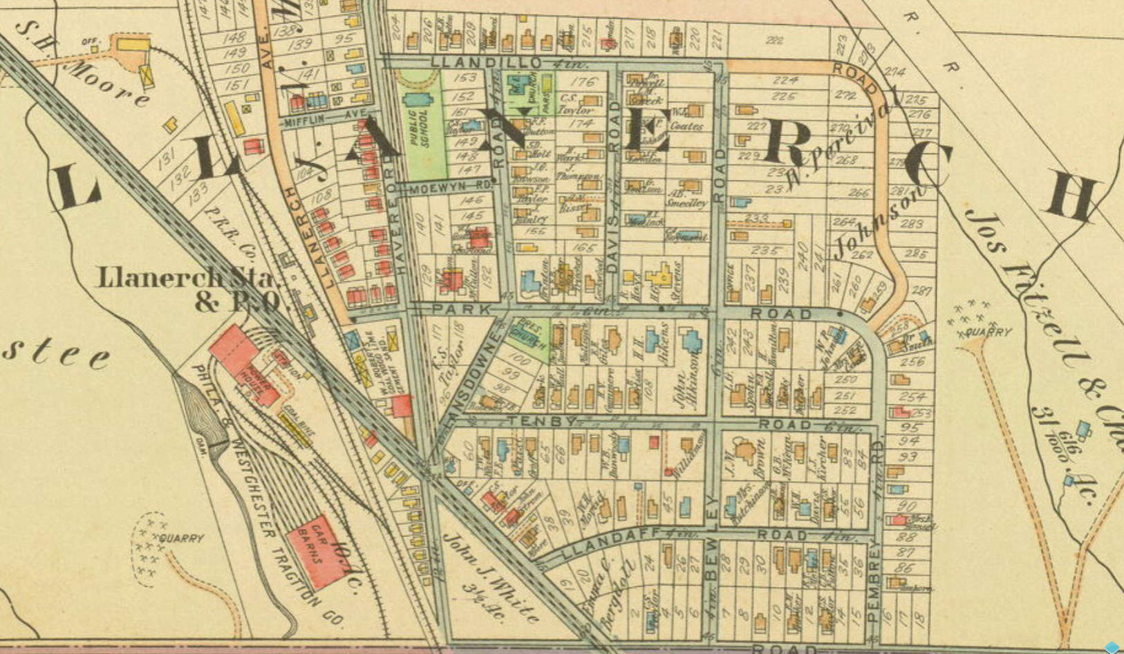
From the 1913 Atlas of Properties
Welcome to Llanerch! Llanerch is a neighborhood more than a 130 years old located in Haverford Township, Pennsylvania. It began to develop in the beginning of the 20th century thanks to the development of "Llanerch Crossing", a railroad junction, connecting it to other parts of Southeastern Pennsylvania making it a desirable neighborhood away from the city (the first "planned community" in Haverford Township). It is bordered by Manoa to the west of Darby Road, Kirklyn and Llanerch Hills to the south of Township Line, Chatham Glen to the east of East Park Road, and Chatham Park to the north of Llandillo and Valley Roads.
The word "Llanerch" comes from the name of a former Welsh commote, Llannerch. The word is a combination of the words "Llan" and "Erch", which together means clearing of land, or open space, referring to its undeveloped state prior to its settlement.
The borders are not 100% defined, but it is generally agreed to be encased by the intersection of Township Line and West Chester Pike. This specific website seeks to cover general knowledge, as well as in-depth histories of every building and street located in the bounds of Township Line to the south, Darby Road to the west, East Park & Valley Roads to the east, and Llandillo Road to the north. Colloquially, I am referring to this section as Upper Llanerch, since it's located at the highest point in the neighborhood.